Drones in Sicily: Aerial Photography Guide to the Mediterranean Island
Drones in Sicily: Aerial Photography on the Mediterranean Island
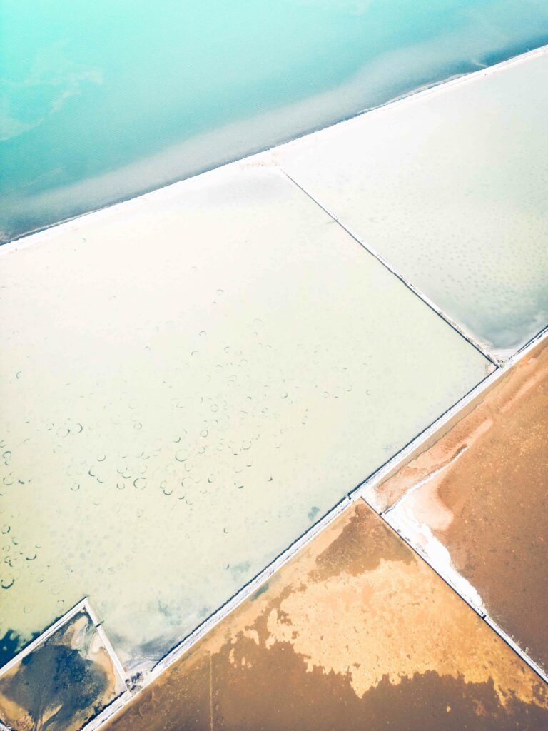
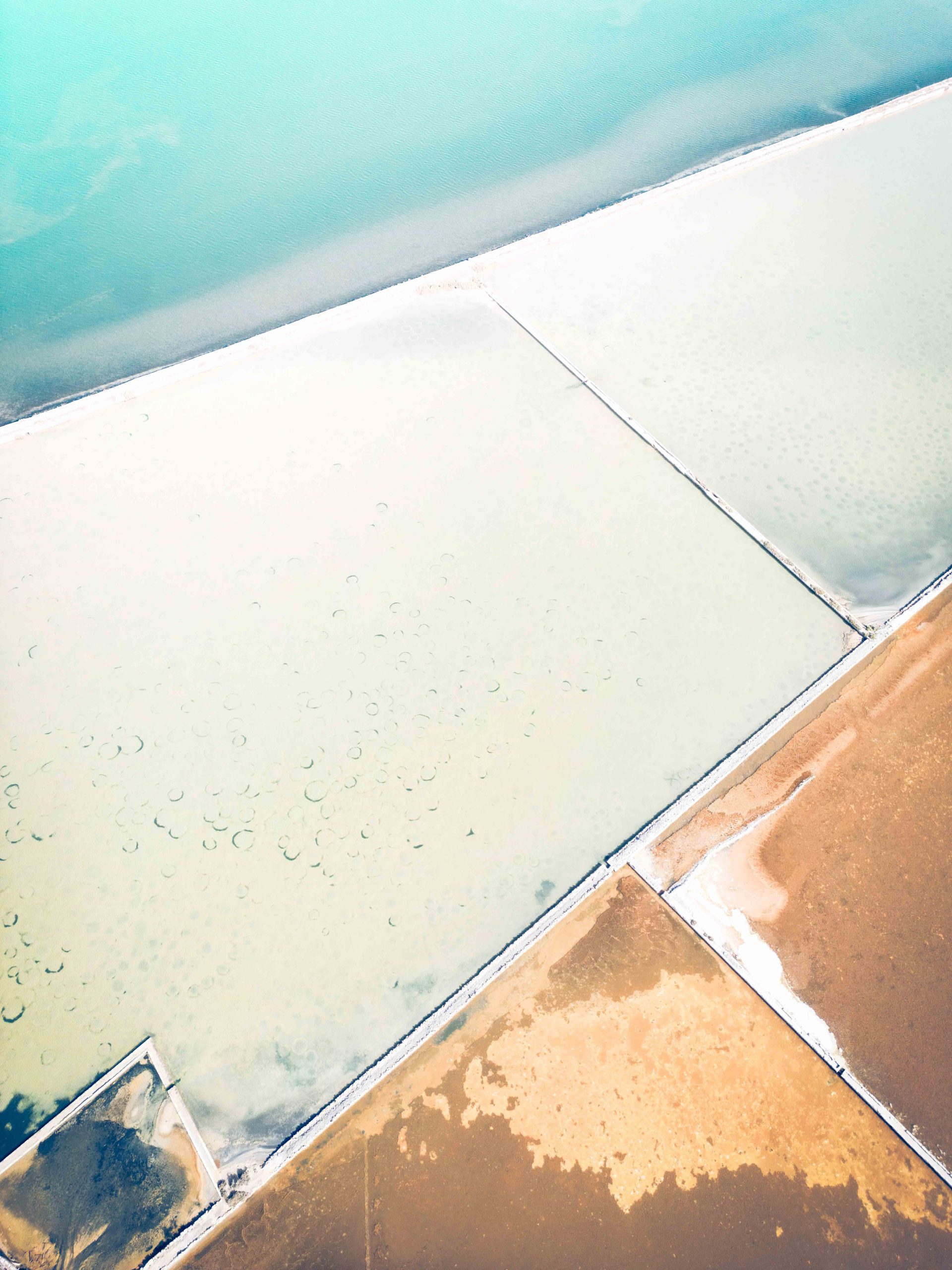
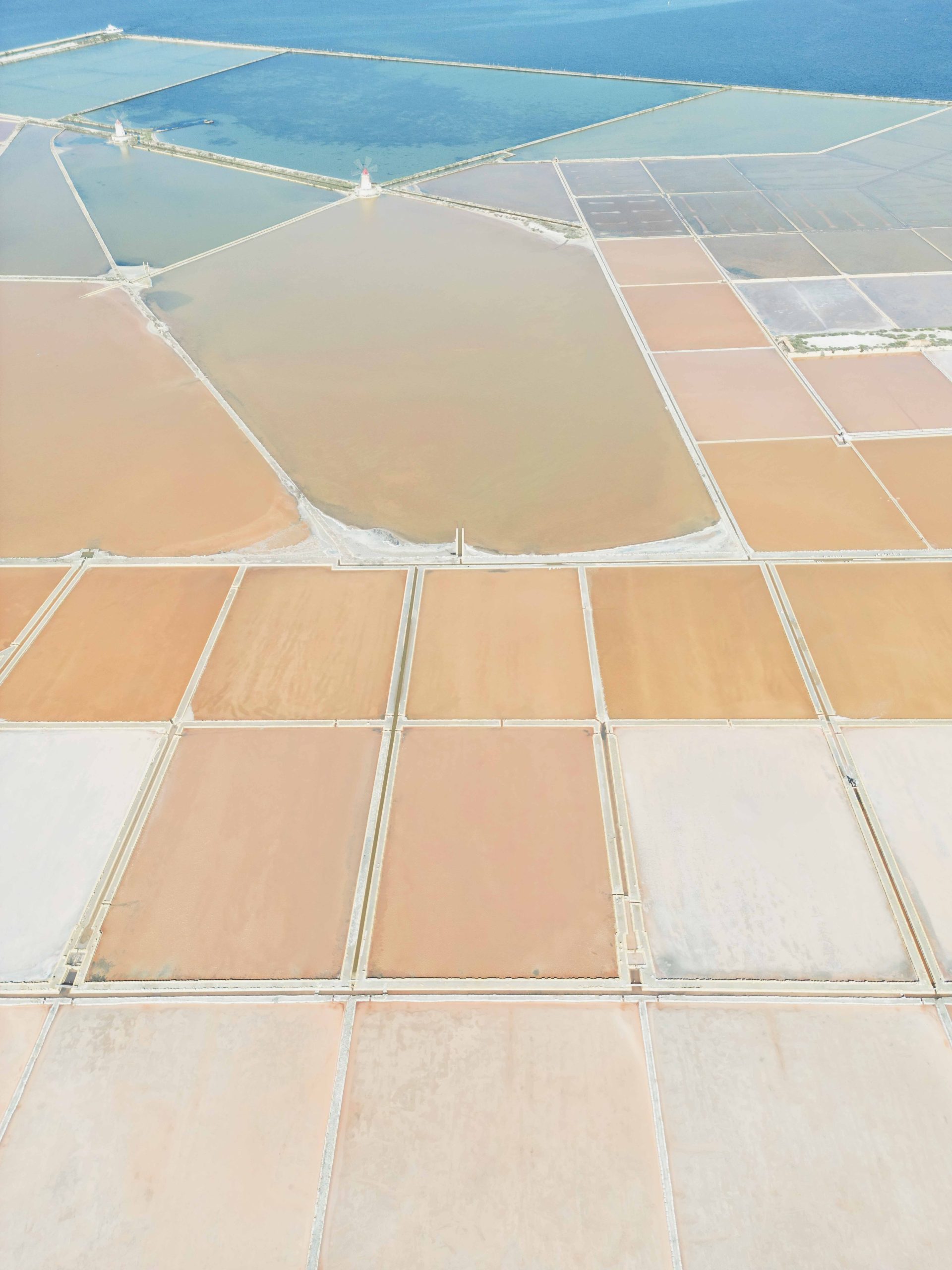
The first time I flew a drone over the Saline di Marsala, I understood something about Sicily that ground-level photography had never fully revealed. The salt pans — which from the road read as a flat, reflective surface punctuated by windmills and reed screens — became from eighty metres above something completely different: a geometric composition of rectangular pools in different stages of evaporation, each one a slightly different colour depending on its salinity, ranging from pale turquoise through rose to the deep terracotta of the fully crystallised pans at the end of the harvest cycle.
That was the beginning of a different understanding of the island. Drone photography in Sicily is not, for me, about getting a wider view. It is about revealing the underlying geometry and colour logic of a landscape that ground-level photography can only partially communicate.
Sicily’s geography reads differently from above. The volcanic coast of Etna, the archaeological sites of the Valle dei Templi, the salt marshes of the west coast, the land art of the Cretto di Burri — all of these become more abstract. More structural. More honest about what the landscape actually is beneath its surface appearance.
This guide covers the best locations for drone photography in Sicily in 2026, the ENAC regulations that govern where and how you can fly, and the specific visual conditions that make each location worth the flight. As with the Drones in Tuscany guide and the complete Italy drone guide, this is not a technical manual. It is a visual essay on what the elevated eye finds here — and a practical reference for the regulation framework that determines where you can find it.
Why Sicily Is One of the Most Rewarding Locations for Drone Photography in Italy
The Light Works Differently Here
Sicily offers aerial photography conditions unlike any other Italian region. The light is harder and more directional than Tuscany. For drone photography, however, this is an advantage rather than a limitation.
Hard light creates stronger shadows. Stronger shadows reveal the geometry of the landscape more clearly. From above, the terraced hillsides, the lava fields of Etna and the geometric salt pans of the west coast all read as abstract compositions. The midday harshness that makes ground-level photography difficult actually enhances aerial work here.
Visual Diversity Unmatched in Italy
In addition, the island offers a visual range that no other Italian region can match. Within a single day of flying you can move between four completely different aerial subjects.
First, the geometric abstraction of a salt pan at golden hour. Then, the land art geometry of the Cretto di Burri. Next, the blue-water clarity of a coastal bay. Finally, the volcanic texture of an Etna lava field. Each requires a different altitude, a different direction of flight and a different relationship between light and subject. As a result, Sicily from above is genuinely inexhaustible.
The Images Are Still Available
Compared to Tuscany — which is significantly more saturated with drone photographers — Sicily remains largely undiscovered from the air. The visual grammar of Sicily from above is not yet established. That is the creative opportunity. The images you make here can still genuinely be yours.
ENAC Drone Regulations in Sicily: What You Need to Know in 2026
Sicily follows the same EU drone framework (EU 2019/947) implemented through ENAC that applies across Italy. The regulation is consistent throughout the country — what changes in Sicily relative to Tuscany are the specific restricted zones near airports (Palermo Falcone-Borsellino, Catania Fontanarossa, Trapani Birgi) and the protected natural areas that cover significant portions of the coastline and interior.
| Drone weight | Category | Certificate required | Key restrictions in Sicily |
|---|---|---|---|
| Under 250g DJI Mini 3, Mini 4 Pro |
Open A1 | None — register operator on D-FLIGHT | Max 120m. Cannot fly over beaches in high season or within restricted airport zones. Most rural and agricultural areas permitted. |
| 250g – 900g | Open A1/A3 | A1/A3 certificate (free online, D-FLIGHT) | 150m from residential areas in A3. Protected nature reserves require specific authorisation. Register drone and operator. |
| Over 900g | Open A2 | A2 certificate (practical + theoretical) | 30m safety distance from people. Stricter zone restrictions near Palermo, Catania and Trapani airport corridors. |
| All drones | Universal | — | No night flying. No airports. Direct visual contact required. Max 120m AGL. No flight over crowds or beaches with bathers. |
Sicily-specific restrictions to note: The Riserva Naturale dello Stagnone di Marsala (which includes the Saline di Marsala) is a protected area — flight authorisation requires contacting the reserve management in advance. The Valle dei Templi near Agrigento is an archaeological heritage site with additional restrictions. The coastline around Ustica, Pantelleria and the Aeolian Islands has specific airspace rules — always verify before visiting these offshore locations.
Best Locations for Drone Photography in Sicily: Four Landscapes as Visual Problems
These are not viewpoints. They are visual conditions — each one requiring a different understanding of what the elevated eye reveals that ground-level photography cannot. Each also requires a different regulatory preparation before the flight.
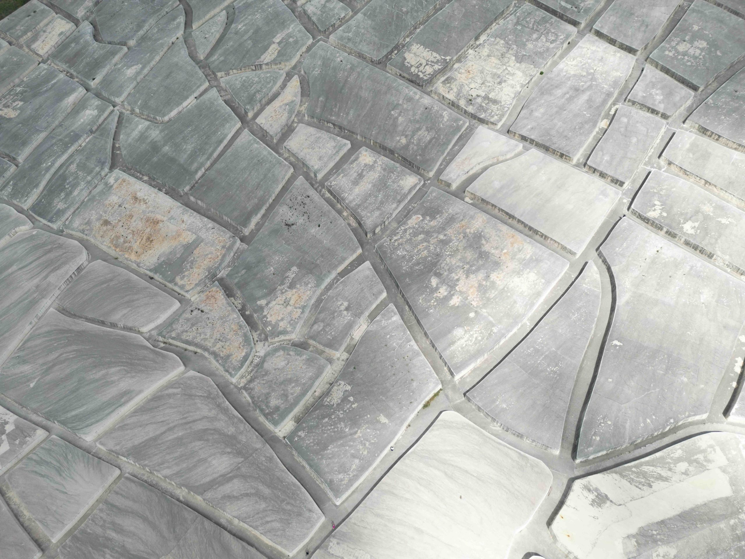
- Cretto di Burri, Gibellina — Land Art as Aerial Subject The Cretto di Burri is one of the most extraordinary aerial photography subjects in Italy — and almost entirely unknown outside of specialist art circles. Alberto Burri’s monumental land art work covers the ruins of Gibellina Vecchia, destroyed in the 1968 Belice earthquake, with an enormous concrete topography of white fissures that follows the street plan of the original city. From the ground it reads as a series of low concrete walls. From above it reveals its full logic: an abstract map of a city that no longer exists, the fissures casting precise shadows at low light angles that define the geometry with extraordinary clarity. Dawn light in October or November — when the sun is low enough to create long shadows inside the concrete channels — is optimal. Verify D-FLIGHT coordinates before flying; the site is in open agricultural land with no specific restrictions, but confirm before each visit.
- Saline di Marsala — The Salt Pans at Golden Hour The salt pans of Marsala, on the western coast between Marsala and Trapani, are the finest aerial photography subject on the island for colour and geometric abstraction. From directly above, the rectangular evaporation pools — each at a different stage of the salt production cycle — form a gradient of colour from pale blue through rose-pink to the deep terracotta of the fully crystallised pans. The windmills that punctuate the salt pans add vertical structure. The golden hour light turns the water surfaces amber and intensifies the colour differentiation between pools. The Saline di Marsala falls within the Riserva Naturale dello Stagnone di Marsala — contact the reserve management for formal authorisation before flying, and always verify current restrictions on D-FLIGHT.
- Isola delle Femmine — The Protected Island and Coastline The small island of Isola delle Femmine, near Palermo, is a protected nature reserve with a lagoon of extraordinary colour clarity. From above, the shallow water around the island ranges from pale turquoise near the shore to deep blue in the channel, with the geometry of the island itself — elongated, low, fringed by sandy beaches — readable as a pure coastal abstraction. The mainland coastline opposite the island has its own visual logic from above: the geometry of the salt works, the road that runs along the shore, the relationship between the built environment and the water. The protected status of the island means flying directly over it may require authorisation — always verify current zone status on D-FLIGHT and fly from the coastal side rather than directly over the reserve.
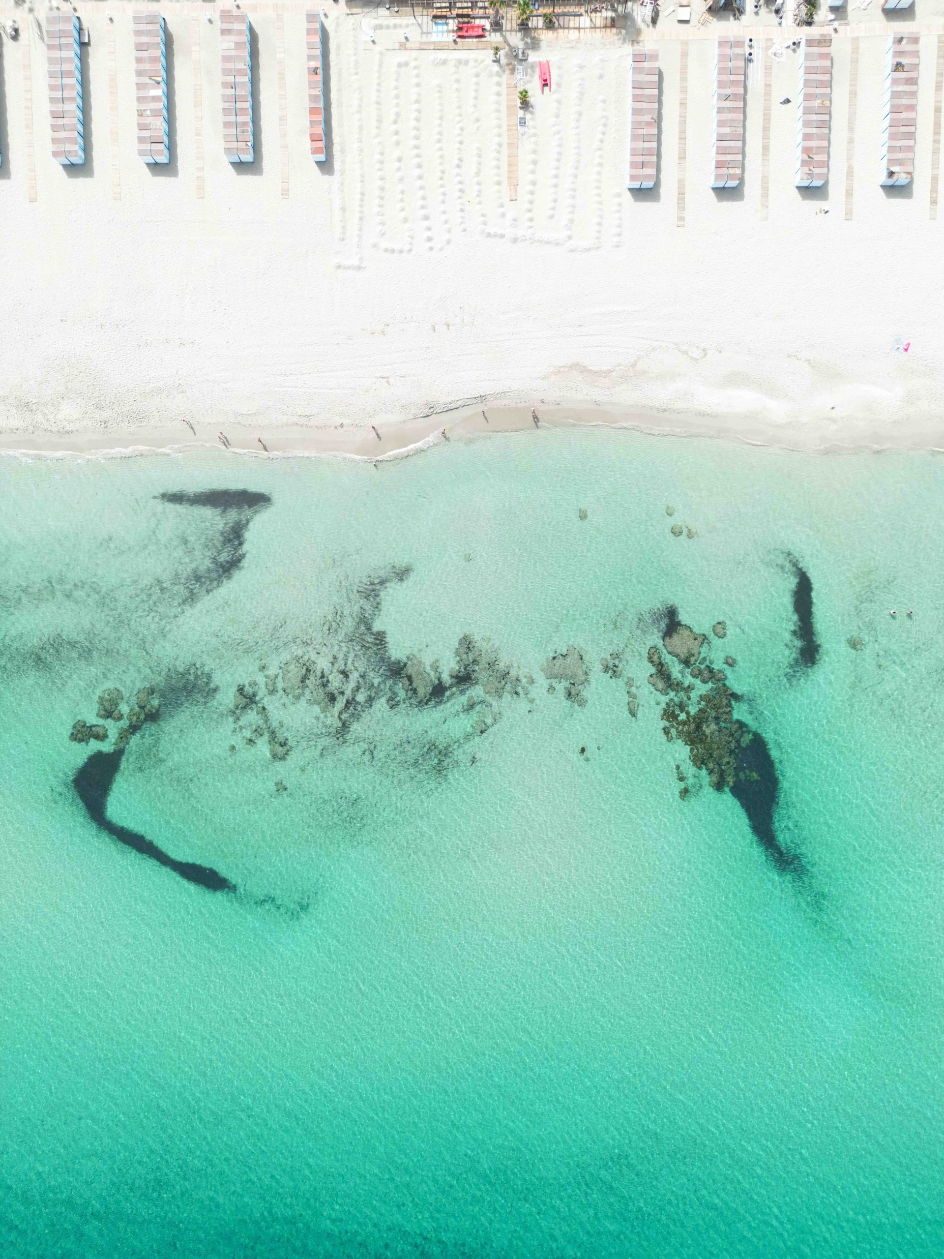
- Mondello — Bay Geometry and Mediterranean Colour The bay of Mondello, north of Palermo, is one of those coastal subjects where the aerial view reveals the geometry that ground-level photography completely obscures. The horseshoe shape of the bay, the pier extending into the water, the colour gradient from the shallow sand-bottomed nearshore to the deeper blue of the open sea — all of this is only fully legible from above. The early morning, before the beach activity begins, produces the clearest water and the most legible coastal geometry. Avoid flying directly over populated beaches during high season — check D-FLIGHT for the specific coordinates. The western headland of the bay, and the view looking inward from offshore, are the strongest aerial compositions.
Light and Approach: How Sicilian Light Differs from Tuscany for Drone Photography
Harder Light, Stronger Images
The key difference between drone photography in Sicily and in Tuscany is the quality of the light. Tuscany’s light is warm, diffused and forgiving. It produces beautiful images across a wide window of the day.
Sicily’s light is harder and less forgiving. However, this is not a disadvantage for aerial work. The shadows it creates at low sun angles are stronger. The contrast between lit and unlit surfaces is greater. For the photographer who understands it, Sicilian light at the right hour produces aerial images of considerably greater visual power.
When to Fly
Fly during the first thirty minutes after sunrise and the last thirty minutes before sunset. Outside these windows, the aerial light is generally too harsh for fine art work.
For example, the shadow cast by a windmill across a salt pan at 6:30am in October is a graphic element that does not exist at any other hour. The fissures of the Cretto di Burri at the same hour are defined by shadow in a way that midday sun completely eliminates.
Fly Lower Than You Think
In Sicily, fly lower than you might instinctively choose. Between 40 and 70 metres is often more interesting than the legal maximum of 120 metres.
At 120 metres, the Saline di Marsala reads as a flat pattern. At 50 metres, in contrast, the individual crystal formations on the salt surface, the reed screens between pools and the windmill structures are all present in the same frame. The relationship between subject, shadow and context is more legible at lower altitude. As a result, the images are more specific — and more yours.
Ethics and Responsibility: Flying a Drone in Sicily with Care
Protected Areas Require Particular Care
Sicily has a complex relationship with its own landscape. The protected areas — the Riserva dello Stagnone, the Riserva di Monte Cofano, the Riserva della Foce del Fiume Platani — exist because the island’s coastal ecosystems are genuinely fragile.
For example, a drone flight over a nesting area at the Saline di Marsala during breeding season (March through July) can cause significant disruption. Flamingos, herons and other migratory bird populations use the reserve regularly. This is not a hypothetical concern. It is a documented impact that irresponsible drone use has caused in protected areas across Italy.
The Discipline I Apply
The approach I use in Sicily is the same I apply in Tuscany. Know the regulation zone before arriving — not at the launch point. Verify GPS coordinates on D-FLIGHT in advance. For protected areas, contact the reserve management before travelling, not on the day of the flight.
Fly once, precisely, for the image you have already visualised. Then land. A focused, prepared flight takes less than ten minutes. As a result, the images are almost always better than those from an exploratory hover — and the place remains as you found it.
Why It Matters
Sicily’s landscapes are extraordinary precisely because they have not yet been saturated by aerial photography. That scarcity is worth protecting.
Fly with care. Not because the regulation requires it. Because the place deserves it.
Aerial and Ground-Level Photography of Sicily — Combined in One Experience
Drone photography guidance in permitted areas is included in the extended Sicily photography experience. All flight zones are verified on D-FLIGHT before each session. Ground-level and aerial photography of the same landscapes — the Saline di Marsala, the Cretto di Burri, the Baroque cities of the southeast — produce a body of work that neither approach achieves alone.
Discover the Sicily Photography Workshop →Frequently Asked Questions — Drones in Sicily
Can I fly a drone in Sicily?
Yes, in most rural and coastal areas of Sicily drone flight is permitted under ENAC regulations. Drones under 250g can be flown without a license in many open areas. Always check D-FLIGHT (d-flight.it) before each flight — areas near airports, urban centres and protected nature reserves have specific restrictions that vary by GPS coordinate.
Do I need a license to fly a drone in Sicily in 2026?
Drones under 250g in Open Category A1 need no license in many conditions. 250g–900g requires the free A1/A3 certificate via D-FLIGHT. Over 900g requires the A2 certificate. All operators must register on D-FLIGHT regardless of drone weight.
Can I fly a drone over the Saline di Marsala?
The Saline di Marsala is a protected nature reserve (Riserva Naturale dello Stagnone di Marsala). Drone flight in protected areas requires specific authorisation. Always verify with exact GPS coordinates on D-FLIGHT before flying and contact the reserve management for formal authorisation for aerial photography — particularly during the bird nesting season (March–July).
What are the best locations for drone photography in Sicily?
The Cretto di Burri near Gibellina for abstract land art geometry, the Saline di Marsala for salt pan colour gradients at golden hour, Isola delle Femmine for the protected island and coastal lagoon, Mondello bay for coastal geometry and Mediterranean colour, and the Valle dei Templi near Agrigento for archaeological aerial perspective. All require D-FLIGHT verification before flying at each specific GPS location.
What is the best time of day for drone photography in Sicily?
The first thirty minutes after sunrise and the last thirty minutes before sunset. Sicilian light is harder and more directional than Tuscany — the low-angle shadows it creates in these windows define the landscape geometry in ways that midday light completely eliminates. For the salt pans at Marsala, golden hour turns the water amber. For the Cretto di Burri, raking morning light reveals the depth of the concrete fissures.
Is drone photography included in the Sicily photography workshop?
Yes. Drone photography guidance in permitted areas is included in the extended Sicily experiences. All flight zones are pre-checked on D-FLIGHT before each session. The Sicily Photography Workshop combines ground-level and aerial photography of the same landscapes for a complete visual body of work.